
Saturday, July 24, 2010

Saturday, July 17, 2010
Week 9 - Homeland Security for Colorado

What a doozy!!! This lab could have gone much smoother if the data would have extracted properly. The files were extremely large and through trial and error I realized that once I was finished with a file, delete it. The raster file repaired easily butI could not figure out exactly how to set the scale to match the rest of the layers. I used NAD 83 UTM 13N and still would not work. I ended up with 6 layers. I was unable to locate the elevation files...and the structures layer was skipped. I am happy to report that the server did not freeze up once...very nice.
Wednesday, July 7, 2010


Tuesday, June 29, 2010

Tuesday, June 22, 2010


Tuesday, June 15, 2010


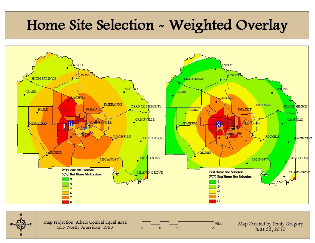
Sunday, June 13, 2010
Week 4 - Participation Activity
Geographic Information Systems (GIS) play a major role in disaster response. With any disaster, obtaining spatial information is a crucial element. The use of GIS can help with planning and recovery efforts. With regards to the Deepwater Oil gush in the Gulf of Mexico, GIS is a vital tool utilized by all entities involved with the clean up efforts. The maps produced through GIS provide useful information about wildlife and plant species, which in turn has guided desicions made by these entities. It has also illustrated the location of the oil as well as it's possible path.
Subscribe to:
Comments (Atom)
